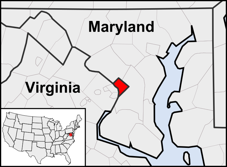
Fil:Washington, D.C. locator map.svg

Storleken för denna PNG-förhandsvisning av denna SVG-fil: 750 × 550 pixlar. Andra upplösningar: 320 × 235 pixlar | 640 × 469 pixlar | 1 024 × 751 pixlar | 1 280 × 939 pixlar | 2 560 × 1 877 pixlar.
Originalfil (SVG-fil, standardstorlek: 750 × 550 pixlar, filstorlek: 160 kbyte)
Filhistorik
Klicka på ett datum/klockslag för att se filen som den såg ut då.
| Datum/Tid | Miniatyrbild | Dimensioner | Användare | Kommentar | |
|---|---|---|---|---|---|
| nuvarande | 23 juli 2011 kl. 05.23 |  | 750 × 550 (160 kbyte) | Patrickneil | Reverted to version as of 03:04, 23 July 2011 |
| 23 juli 2011 kl. 05.21 |  | 750 × 550 (161 kbyte) | Patrickneil | Reverted to version as of 03:14, 23 July 2011 | |
| 23 juli 2011 kl. 05.20 |  | 750 × 550 (161 kbyte) | Patrickneil | frame | |
| 23 juli 2011 kl. 05.14 |  | 750 × 550 (161 kbyte) | Patrickneil | thicker frame | |
| 23 juli 2011 kl. 05.04 |  | 750 × 550 (160 kbyte) | Patrickneil | straightening Maryland and Delaware borders | |
| 15 augusti 2010 kl. 04.09 |  | 750 × 550 (202 kbyte) | Patrickneil | Delaware River again | |
| 15 augusti 2010 kl. 03.51 |  | 750 × 550 (274 kbyte) | Patrickneil | Delaware River border | |
| 15 augusti 2010 kl. 03.42 |  | 750 × 550 (273 kbyte) | Patrickneil | forgot border on Smith Island | |
| 15 augusti 2010 kl. 03.34 |  | 750 × 550 (273 kbyte) | Patrickneil | county borders below state | |
| 15 augusti 2010 kl. 03.32 |  | 750 × 550 (274 kbyte) | Patrickneil | changes by request |
Filanvändning
Följande 2 sidor använder den här filen:
Global filanvändning
Följande andra wikier använder denna fil:
- Användande på af.wikipedia.org
- Användande på an.wikipedia.org
- Användande på ar.wikipedia.org
- Användande på arz.wikipedia.org
- Användande på as.wikipedia.org
- Användande på azb.wikipedia.org
- Användande på bh.wikipedia.org
- Användande på bs.wikipedia.org
- Användande på ceb.wikipedia.org
- Användande på ckb.wikipedia.org
- Användande på en.wikipedia.org
- Användande på en.wikinews.org
- Användande på es.wikipedia.org
- Användande på es.wiktionary.org
- Användande på et.wikipedia.org
- Användande på fr.wikipedia.org
- Användande på fr.wiktionary.org
- Användande på fy.wikipedia.org
- Användande på gv.wikipedia.org
- Användande på hu.wikipedia.org
- Användande på ia.wikipedia.org
- Användande på id.wikipedia.org
- Användande på ilo.wikipedia.org
- Användande på incubator.wikimedia.org
- Användande på it.wikipedia.org
- Användande på jam.wikipedia.org
- Användande på ja.wikipedia.org
- Användande på jbo.wikipedia.org
- Användande på ko.wikipedia.org
- Användande på lb.wikipedia.org
- Användande på lfn.wikipedia.org
- Användande på ln.wikipedia.org
- Användande på mi.wikipedia.org
Visa mer globalt användande av denna fil.
