
Fil:Map of the Philippines Demis.png

Storlek på förhandsvisningen: 397 × 599 pixlar. Andra upplösningar: 159 × 240 pixlar | 318 × 480 pixlar | 814 × 1 228 pixlar.
Originalfil (814 × 1 228 pixlar, filstorlek: 299 kbyte, MIME-typ: image/png)
| Denna fil tillhandahålls av Wikimedia Commons. Informationen nedan är kopierad från dess filbeskrivningssida. |
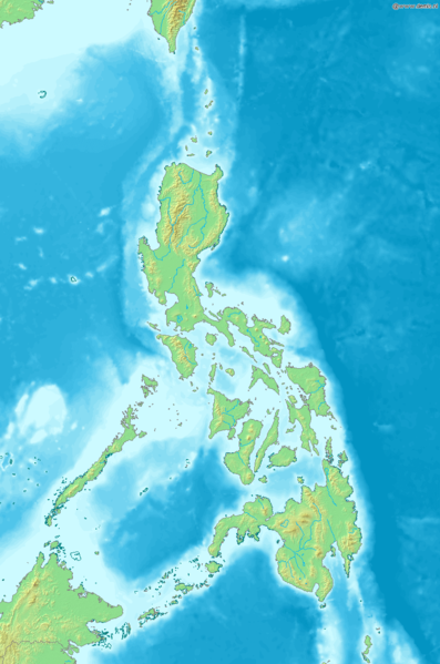
Map of the Philippines
Bounding box West 115.5°, South 3.7°, East 129°, North 23.5°. Center at 13°36′00″N 122°15′00″E / 13.60000°N 122.25000°E.
This image is in the public domain because it came from the site https://www.demis.nl/products/web-map-server/examples/ and was released by the copyright holder. Permission is granted to copy, distribute and/or modify this map since it is based on free of copyright images from: www.demis.nl. See also approval email on de.wp and its clarification.
|
| This work has been released into the public domain by its copyright holder, www.demis.nl. This applies worldwide. I vissa länder kan detta inte vara juridiskt möjligt; i så fall: www.demis.nl ger envar rätten att använda detta verk för alla ändamål, utan några villkor, förutom villkor som lagen ställer.
|
Filhistorik
Klicka på ett datum/klockslag för att se filen som den såg ut då.
| Datum/Tid | Miniatyrbild | Dimensioner | Användare | Kommentar | |
|---|---|---|---|---|---|
| nuvarande | 20 december 2006 kl. 20.04 | | 814 × 1 228 (299 kbyte) | Mats Halldin~commonswiki | Map of the Philippines Bounding box West 115.5°, South 3.7°, East 129°, North 23.5°. Center at {{coor d|13.60000|N|122.25000|E|scale:11880000}}. {{demis-pd}} Category:Maps of the Philippines |
Filanvändning
Följande sida använder den här filen:
Global filanvändning
Följande andra wikier använder denna fil:
- Användande på diq.wikipedia.org
- Användande på en.wikipedia.org
- Användande på eo.wikipedia.org
- Användande på es.wikipedia.org
- Användande på la.wikipedia.org
- Användande på mg.wikipedia.org
- Användande på sq.wikipedia.org
- Användande på uk.wikipedia.org