
Fil:Map of USA HI full.png
Det finns ingen version med högre upplösning.
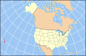
Map_of_USA_HI_full.png (286 × 186 pixlar, filstorlek: 21 kbyte, MIME-typ: image/png)
| Denna fil tillhandahålls av Wikimedia Commons. Informationen nedan är kopierad från dess filbeskrivningssida. |
Sammanfattning

|
Det finns en vektorversion av denna rasterbild (SVG).
När vektorbilden är lämpligare ska den användas istället för rasterbilden. File:Map of USA HI full.png → File:Map of USA HI full.svg
För mer information om vektorgrafik, se artikeln Commons transition to SVG (på engelska). |
 |
| Beskrivning | Map of USA with Hawaii highlighted and shown in true position |
| Källa | http://www.nationalatlas.gov/printable/reference.html |
| Skapare |
Licensiering
This map was obtained from an edition of the National Atlas of the United States. Like almost all works of the U.S. federal government, works from the National Atlas are in the public domain in the United States.
Online access: NationalAtlas.gov | 1970 print edition: Library of Congress, Perry-Castañeda Library
|
Filhistorik
Klicka på ett datum/klockslag för att se filen som den såg ut då.
| Datum/Tid | Miniatyrbild | Dimensioner | Användare | Kommentar | |
|---|---|---|---|---|---|
| nuvarande | 2 april 2007 kl. 18.30 | | 286 × 186 (21 kbyte) | MattWright | fix to more standard map colors |
| 1 april 2007 kl. 21.09 |  | 286 × 186 (19 kbyte) | MattWright | {{Information |Description=Map of USA with Hawaii highlighted and shown in true position |Source=http://www.nationalatlas.gov/printable/reference.html |Date= |Author= |Permission= |other_versions= }} Category:Maps of the United States [[Category:Maps |
Filanvändning
Följande 5 sidor använder den här filen:
Global filanvändning
Följande andra wikier använder denna fil:
- Användande på bcl.wikipedia.org
- Användande på bo.wikipedia.org
- Användande på da.wikipedia.org
- Användande på en.wikipedia.org
- Användande på es.wikipedia.org
- Användande på fa.wikipedia.org
- Användande på hu.wikipedia.org
- Användande på id.wikipedia.org
- Användande på ja.wikipedia.org
- Användande på ko.wikipedia.org
- Användande på mrj.wikipedia.org
- Användande på mr.wikipedia.org
- Användande på pl.wikipedia.org
- Användande på pl.wikinews.org
- Användande på pl.wiktionary.org
- Användande på ro.wikipedia.org
- Användande på uk.wikipedia.org
- Användande på vi.wikipedia.org