
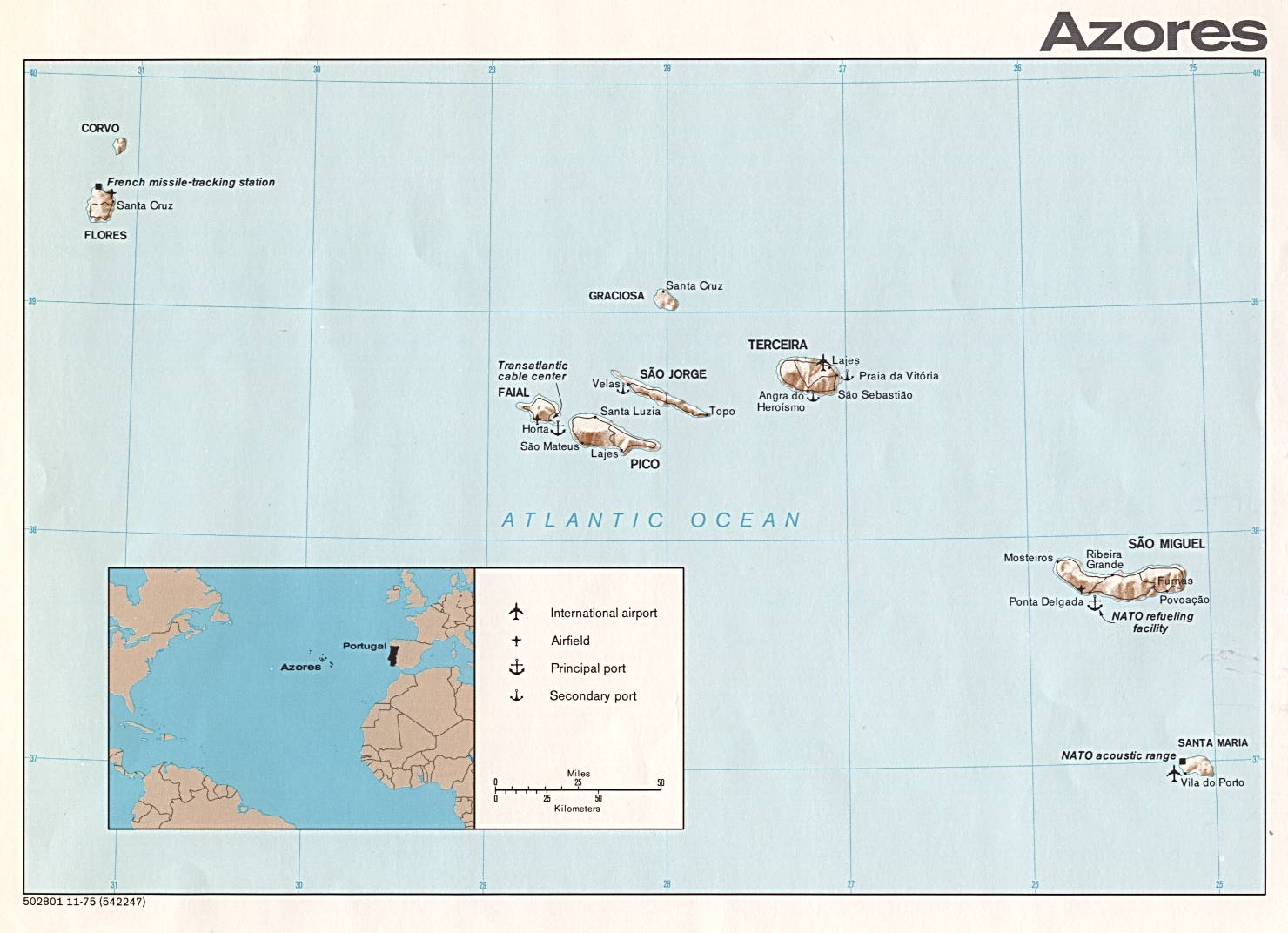
Fil:Azores CIA.jpg

Storlek på förhandsvisningen: 800 × 539 pixlar. Andra upplösningar: 320 × 216 pixlar | 640 × 431 pixlar | 1 024 × 690 pixlar | 1 433 × 966 pixlar.
Originalfil (1 433 × 966 pixlar, filstorlek: 125 kbyte, MIME-typ: image/jpeg)
| Denna fil tillhandahålls av Wikimedia Commons. Informationen nedan är kopierad från dess filbeskrivningssida. |
Sammanfattning


Licensiering
This map is part of this list of Europe maps from the Perry-Castañeda Library (PCL) of the University of Texas at Austin which are said to have been produced by the Central Intelligence Agency unless otherwise indicated.
| This image is a work of a Central Intelligence Agency employee, taken or made as part of that person's official duties. As a Work of the United States Government, this image or media is in the public domain in the United States.
|

|
Filhistorik
Klicka på ett datum/klockslag för att se filen som den såg ut då.
| Datum/Tid | Miniatyrbild | Dimensioner | Användare | Kommentar | |
|---|---|---|---|---|---|
| nuvarande | 20 februari 2014 kl. 19.39 | | 1 433 × 966 (125 kbyte) | Capmo | margins cropped |
| 24 april 2006 kl. 14.28 |  | 1 480 × 1 072 (142 kbyte) | Islandspec~commonswiki | ||
| 5 mars 2006 kl. 19.43 |  | 1 480 × 1 072 (142 kbyte) | Brian Boru | {{PD-PCL|azores.jpg|islands_oceans_poles/}} Category:Maps of Azores |
Filanvändning
Inga sidor använder den här filen.
Global filanvändning
Följande andra wikier använder denna fil:
- Användande på az.wikipedia.org
- Användande på br.wikipedia.org
- Användande på en.wikipedia.org
- Användande på eo.wikipedia.org
- Användande på fi.wikipedia.org
- Användande på fr.wiktionary.org
- Användande på kk.wikipedia.org
- Användande på mk.wikipedia.org
- Användande på nl.wikipedia.org
- Användande på pt.wikipedia.org
- Användande på rue.wikipedia.org
- Användande på ru.wikipedia.org
- Användande på uk.wikipedia.org
- Användande på www.wikidata.org